I read a blog post two years ago about the Pueblos Mancomunados – eight remote Zapotec villages north of Oaxaca City that are protected as part of an ecotourism project. For hundreds of years the villages have pooled profits from their natural resources and now they’ve also turned to ecotourism to boost their economies. After devouring the beautiful photos and colourful descriptions in the blog post by ‘Desk to Glory’, the Pueblos Mancomunados crept onto my bucket list.
The morning of our trip up to Benito Juarez (1 of the 8 villages), we took our time lazily getting Sally ready for the short 1-hour drive into the mountains from Oaxaca city. We followed our GPS onto HWY 190 and soon started seeing signs for Parque Nacional Benito Juarez. It didn’t take long to realize that the local signage and GPS did not agree on the route. Blindly following our GPS has gotten us into trouble before so we decided to follow the local signage instead. The route led us through the little village of Teotitlan del Valle and then to a ‘closed road’ sign. Sigh. Determined not to turn back, we used Google to choose what appeared to be a short, easy detour. Our detour quickly turned into a dirt road, which kept getting narrower, twisty-er and rockier. Evidence of other vehicles disappeared and we had to pull over to make room for locals guiding herds of cows. Just as we were getting really nervous, the detour finally led back to the main road, which turned out to be a slightly wider, winding, dirt road.


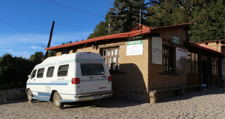
Thank god Marc was driving as we slowly climbed the switchbacks. The road was only wide enough for one vehicle so every once in a while, we had to pull over to let by a much more capable local truck. As we neared the top, Sally began to labour and we noticed the engine was getting hot. Marc pulled over, opened the windows and cranked up the heat. Walter and I were none too pleased with this arrangement but it worked and after climbing 1,500 m to 3,000 m above sea level (in 2.25 hrs instead of 1!), Sally got us to the Tourism Office, where they let us park the van for a couple of nights.
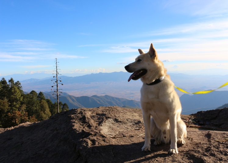
Exhausted, we stumbled into the comedor (eatery) in Benito Juarez looking for lunch. Dogs aren’t allowed in the comedor so we arranged for take out. We were expecting to pick up the food once it was ready but instead, the kitchen staff delighted us by delivering it right to the door of our van. Lunch included rice, beans and green latke-type things, which were delicious. Feeling revived, we arranged for a guided hike to the neighbouring village of La Neveria the next morning and climbed up to the Mirador. The views from the lookout were stunning.

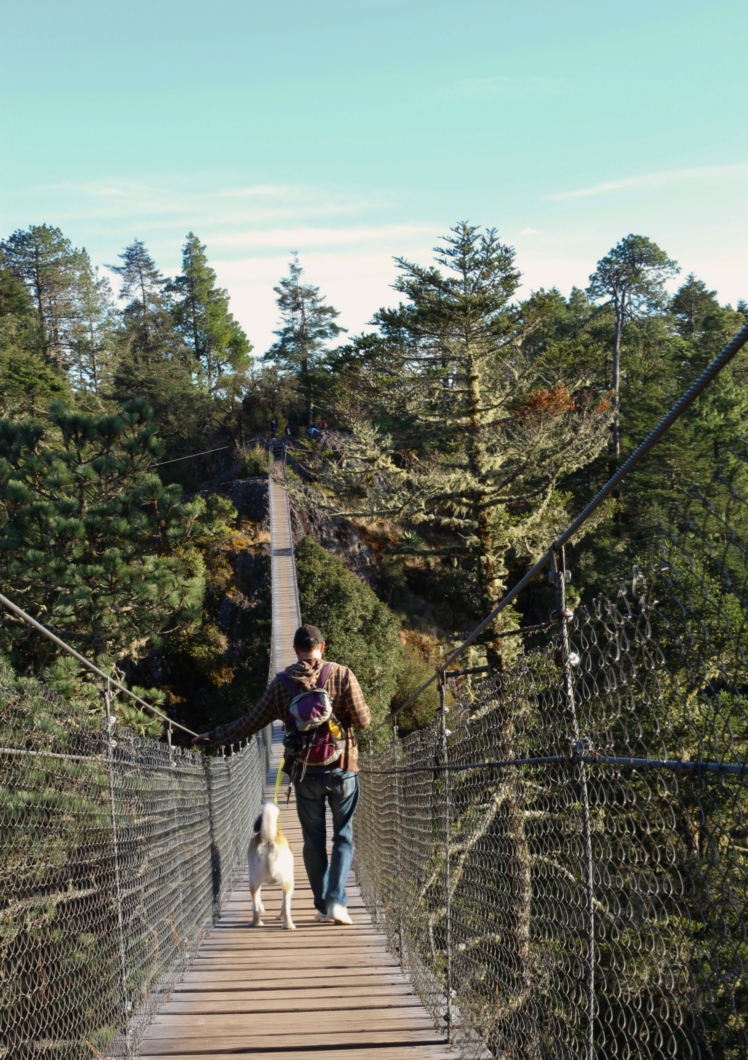
We awoke early the next morning to frigid high altitude temperatures and a quick hearty breakfast in the van. At 9:00 AM, a very small older man introduced himself as Manuel, our hiking guide for the day’s 16-km trek. Manuel spoke no English, which was just fine with us – a perfect opportunity to work on our Spanish. He told us that he is 74 years old and guides this particular route ~ 3 times per week. It’s an ‘easier’ job for him after having to retire from working in the fields. He instantly became our hero.
Manuel knows everyone in the villages and introduced us to locals on our way through. He knew every type of tree and plant variety and explained the names and uses for each as we went. Every once in a while he would test us on the name of a plant, which to his dismay we could never remember. He wasn’t a big fan of taking breaks so photo ops were limited and water had to be sipped quickly before he would announce, ‘vamanos’!
The hike took us past fields growing potatoes, corns and squash, up and down through forests of pines and spruce and every once in awhile, we’d get a fantastic view of the surrounding mountainsides and villages. Manuel labored only slightly as we climbed steep hills – just another day on the job for him. At the end of the hike, he told us that we’d done really well and made excellent time – a huge compliment coming from him! He agreed to let us snap a picture of him before saying goodbye and wishing us luck on our travels.


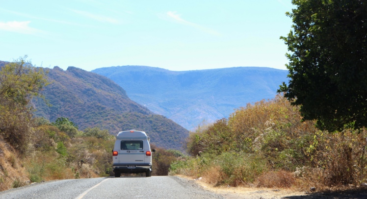
The next morning, armed with local information and adhering to our GPS instructions, we took a different route down the mountain… the PAVED one! Yes, after climbing 1,500 m up a narrow, dirt, switchback road, it turns out there was a nice paved one just to the east… the one Google had wanted us to take. It was much less challenging but just as beautiful and we snapped a couple of great photos of Sally on the way down. You just never know with GPS… sometimes it knows best and sometimes it doesn’t… same goes for local signage. It won’t be the first or last time we end up taking the ‘scenic’ route.
Lessons Learned:
- Sally has a hard time on long climbs in hot weather. Her engine starts to overheat. Turning on the heat and rolling down the windows is an easy but not entirely pleasant fix. Next year we’ll install a newer, higher capacity radiator.
- Sometimes the GPS does know best!
Pro-camper Tips:
- If travelling in a van or camper, the staff at the Parque Nacional will let you park and camp on a flat-ish section of road beside the Tourist Information office. Our understanding was that they charged 60 pesos/person/night to camp in the van but they didn’t charge us for camping, only the park entry fee.
- There’s days worth of hiking to do in the Pueblos Mancomunados. Another time, I would set aside more time and do a multi-day hike through several of the villages, staying over at each village in a tent or in the cabanas they have for rent.

Sally is an older vehicle, no? So it’s quite possible her radiator is partially plugged already, maybe explaining her hot-headedness! Great story of your adventure. In boats AND vans, GPS can never be trusted completely. 😉
LikeLike
Yup! She’s a 1994. We had the rad checked before we left and it looked good so likely isn’t plugged. It’s very possible we’re just asking a little too much for an old van and old rad. Nothing a future upgrade can’t fix though. Re: GPS, you’re right! You just never know. Following local signage is often the best option but in this case, Google knew best 😆
LikeLiked by 1 person
Nice pics, glad Marc remembers some of his basic over-heating trick.Sally was made for flat highways not tring to be a billy goat… Becareful of trany as well. Stay the course and She ll do you find… Be safe and keep thoughts coming…
LikeLiked by 1 person
Thanks Bob! That confirms what we figured, which is that we’re just pushing her a bit out of her comfort zone. Marc says we’ll be coming to see you in the Spring about a new higher capacity rad😉
LikeLike